Header Banner
Gadget Hacks Logo
Gadget Hacks
Internet
gadgethacks.mark.png
Gadget Hacks Shop Apple Guides Android Guides iPhone Guides Mac Guides Pixel Guides Samsung Guides Tweaks & Hacks Privacy & Security Productivity Hacks Movies & TV Smartphone Gaming Music & Audio Travel Tips Videography Tips Chat Apps
Home
Internet

How to Geotag your photos in Picasa by adding them to Google

Apr 24, 2008 06:00 PM
Map view of an urban area with a search bar and location details displayed.

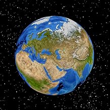
Google Earth is a virtual globe application, that you can use to view the Earth, either as a satellite image, a series of aerial photographs, or a superimposed combination of the two.

When sorting your photos in Picasa, you can automatically add Geotag information to them, by using Google Earth to locate the exact position on the globe where to photo was taken, and in this screencast tutorial, we show you how.

Once you've uploaded your photos to Google Earth, other users will be able to view your photos, simply by clicking on the tag you created.

You already know how to use your phone. With our newsletter, we'll show you how to master it. Each week, we explore features, hidden tools, and advanced settings that give you more control over iOS and Android than most users even know exists.

Sign up for Gadget Hacks Weekly and start unlocking your phone's full potential.

Related Articles

Comments

No Comments Exist

Be the first, drop a comment!